
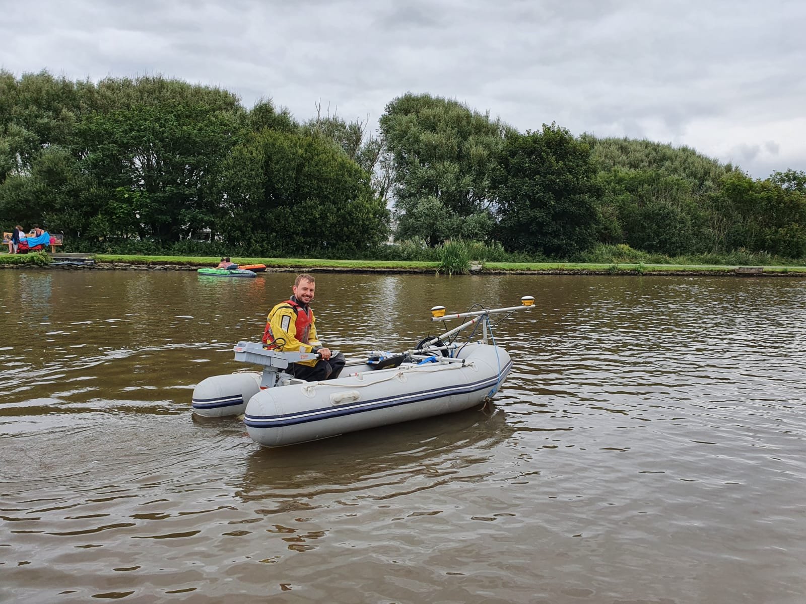
Bathymetry Surveyors

Exo provides a range of bathymetry surveys including: Multibeam bathymetry, Single beam bathymetry, Photogrammetry surveys, Hydrographic surveys and Oceanographic surveys.
If you require a water body surveyed, from a small pond to a large harbour, look no further! Exo can provide you with the collection and processing of bathymetric data. Whether you need to know the depth of the water or directly measure the amount of silt present, we have the ability to find out.
The data can be analysed and processed for easy interpretation in GIS maps and other useful media too. As our client, you can rest assured in the knowledge that your survey data will be based on accuracy and precision by using state-of-the-art equipment.
Water surveys are tailored to your exact needs, even if what you require is not specifically mentioned here, it is likely that we can help you.

WHY CHOOSE EXO?
With our previous track record of successful bathymetry surveys and accurately processed data, you can rest easy knowing that when a bathymetric survey needs to be carried out in a complex environment, Exo will deliver. Your water body will be fully surveyed using incredibly precise equipment (the best the industry has to offer) to give you the best possible readings.
We can also analyse your data to support your licensing (Link to licensing and permitting page) or monitoring needs including the production of reports, graphs, charts and maps!
Please get in touch for us to assign you a personal consultant, who will manage your bathymetry survey and data analysis from start to finish.

Case Studies
-
Exo Environmental were appointed by Brightlingsea Town Council and Brightlingsea Harbour Commissioners to conduct a Water Framework Directive (WFD) assessment, as part of a proposed project involving two significant access improvements across the Brightlingsea Creek.
The aim of the assessment was to identify relevant surface water bodies, understand current WFD classification (determined by the Environment Agency on a regular basis) and determine whether the project could cause deterioration in WFD classification or adversely affect the water body achieving good status in the future.
Firstly, the only water source identified for screening, based on the project location, was the Colne River. Knowing this, we identified its WFD classification (Moderate) and furthermore determined the River Colne does not fall within WFD mitigation measures. Therefore, the project will not impact any active mitigation strategies already implemented.
Exo used the WFD impact assessment matrix (below) to identify and assess how the project’s construction and operational phases could affect each WFD parameter used to discern water quality. These are Biological, Physio-chemical, Hydromorphological and Chemical criterion, and include receptors, such as fish, macroinvertebrates, river flow dynamics, dissolved oxygen, and many others.
Our analysis found that no change will be caused by the majority of activities associated with this project, falling under the ‘No Impact’ descriptor. The highest impacts observed from the analysis were identified as localised adverse effects, exclusively caused by the impact from piling on localised benthic sediment, with a temporally short impact period.
From our analysis Exo concluded that based on the current understanding of the project, the cumulative impacts will not significantly affect the various elements considered of the Colne Water Body. The project is very unlikely to impact the water body status or prevent the potential to achieve future good status.
Status classes for surface waters (EA, 2020)
-
Salhouse Broad is a well-known and favoured destination for recreational boaters and tourists visiting the Norfolk and Suffolk Broads. Downstream along the River Bure from Wroxham, often referred to as “The Capital of the Broads”, Salhouse Broad receives high levels of boating traffic with visitors making use of the public areas along the southern bank. It is therefore important to monitor the silt levels within Salhouse and access channels for potential hazards to navigation and to inform potential maintenance dredging operations.
The Norfolk and Suffolk Broads present a challenging environment in which to conduct bathymetric surveys due to a number of factors including, but not limited to: dense patches of aquatic vegetation, underwater obstacles (E.g. wrecks and fallen trees), signal obscuration from overhanging trees and shallow water depths across much of the National Park.
Blessed with a sunny autumnal day, Exo Environmental performed a bathymetry survey, deploying a dual-frequency Echotrac CV100 echosounder. This equipment performed exceptionally well, successfully and accurately measuring depths as shallow as 0.3m, whilst differentiating between the hard, underlying geology and soft, accumulated surface silts. From mobilization to demobilisation, the survey took ~5 hours to complete, covered an area of ~75,000 m2 and required 4 cups of coffee!
-
A thorough GIS study of Blakeney Channel was requested to complement a recent aerial and topographic survey of the site, conducted by Exo Environmental. Comparing previous survey records with historical aerial photography, provided by the Historic England Archives, this work was to allow changes to the channel morphology and saltmarsh extent over the last 70 years to be identified.
Using our specialist GIS software, historic saltmarsh extents could be overlain with our recent high resolution Unmanned Aerial Vehicle (UAV) (drone) survey data, to locate and quantify losses and gains of this protected habitat. Of particular note, was the growth of approximately 0.5ha of saltmarsh following the rerouting of a drainage rill in the 1990’s, resulting in significant meandering of the Channel.
Channel cross-section datasets from previous survey efforts dating back to the early 1980’s were also digitised from paper drawings supplied, some of which contained limited, erroneous or inaccurate data. Two methods were employed to correct the historic data using: georeferencing, distances quoted on hand drawn maps, changes in saltmarsh extent and accurate topographic data obtained during our survey of the Channel.
Utilising these methods allowed us to maximise accuracy of the digitised datasets and facilitate future comparative studies and long-term management of the Channel.
-
Waterside Marina is situated within a high end riverside residential complex, within Brightlingsea Harbour on the River Colne Estuary in Essex, UK, and provides moorings and shore side facilities for recreational vessels and boat owners.
In 2015, 11,000m3 of accumulated sediments were removed during a major dredging campaign, with the arising sediments being dispersed on the ebb tide. Following this work, the Brightlingsea Harbour has taken responsibility for the site, which includes undertaking regular maintenance dredging to prevent the marina from silting up in the future.
To monitor siltation rates and identify target areas to focus maintenance dredging efforts, a survey was undertaken. However as the season was in full swing with high numbers of moored vessels present which limited access throughout the marina, whilst the surrounding sheet piling and high rise residential blocks satellite reception of the bathymetric and topographic GNSS positioning system was not 100%.
To overcome this issue, a combination of bathymetric and topographic survey techniques were employed to achieve the best possible results. An initial bathymetric survey was undertaken from the Exo Surveyor survey vessel in all accessible areas, subject to satellite coverage.
To obtain data in areas where satellite reception was available but access was limited, a centimeter accurate GNSS topographic system on a sounding rod was deployed. In areas where both access and satellite reception were limited, a manual measurement using a graduated rod was taken to ensure 100% coverage of the marina.
-
Blakeney Channel is an important navigation channel that connects Blakeney Harbour to Blakeney Town and its iconic quayside on the north Norfolk Coast. The area is dynamic and has shown some significant morphological changes over recent decades, including; shifting sandbars, meandering of channel centres and both eroding and accreting saltmarsh.
As part of the ongoing monitoring of the Channel and to facilitate the long-term management of safe navigation channels within Blakeney Harbour, the Blakeney Channel Coastal Community Team (BCCCT) commissioned Exo Environmental to conduct an aerial and topographic survey, to compliment and allow direct comparison with historical data sets, to identify changes to the Channel’s morphology over recent decades.
To achieve this, a photogrammetric survey was undertaken using an aerial drone with a preprogrammed flight path and referenced to a series of ground control points placed over a range of altitudes across the study site.
To support the aerial survey, topographic GNSS equipment was used as a quality check and to obtain data from areas submerged at all states of the tide. The combined dataset was used to create an XYZ grid with <1cm accuracy and a resolution of approximately 2cm per pixel. The resolution of the resultant 3D model is far superior to historic aerial and satellite imagery and comparable to that of LIDAR data accessible from the Environment Agency.
-
A holistic understanding of the environment is critical for the sustainable development and maintenance of infrastructure. With regards to the beneficial use of dredged material (BUDM), particularly its application in habitat creation, restoration and enhancement projects, detailed knowledge of the local topography is fundamental. This allows volume and storage calculations, matching of sources and sinks and facilitating post-works monitoring of processes that typically occur over the medium- to long- term, such as consolidation of material and biological colonisation.
As part of the Brightlingsea Dredging and Restoration project, Exo conducted dual-frequency bathymetric and unmanned aerial vehicle (UAV) (drone) photogrammetric surveys throughout the site, during high and low water spring tides respectively. The high resolution datasets were then merged across the overlapping intertidal zone (an approximate tidal range of 5m) using specialist software, to provide a comprehensive map of levels throughout the Creek.
Applying the clients requested target depths for each dredge area, accurate dredge volumes can be calculated and used to match with the storage volumes of restoration sites selected following the comparison of historic and current saltmarsh extents. In addition to project design, the data obtained also supports project planning through the identification of priority areas, provides baseline data for continued environmental monitoring and assists in the formulation of a long-term management plan for the Brightlingsea Harbour Authority.
The combination of these survey techniques provides excellent data coverage for logistically challenging sites located at the land-water interface such as the intertidal zone.
-
In January 2022, Exo were appointed to carry out a multibeam bathymetry survey focussing on a stretch of the River Orwell, in order to provide reliable data to dredging operations occurring at Woolverstone Marina. The survey area was approximately 130ha, and the survey was conducted over the course of 3 days, in order to maximise time spent surveying at high spring tides.
We used our Arvor 18 vessel for the multibeam survey, including the Norbit IWBMS 400khz sonar head system and the Valeport Swift Sound velocity profiler.
After the survey was completed our dedicated team of hydrographic analysts processed and cleaned the data and sent it to the client to inform on dredging depth requirements.
Our swift response to the client’s query and efficient surveying time allowed us to deliver the data on time and to a high standard.
-
In November 2021, Exo were appointed to carry out a multibeam bathymetry survey of Baltic Wharf, in the River Crouch, Essex. The survey focussed on determining the depth to chart datum around a 100mx15m long jetty, at a distance of 50m on the outside and 25m on the inside of the structure.
Using our experience of working within this environment and conducting a plethora of bathymetric surveys, we planned to carry out the survey at the highest state of tide, to give our multibeam system the best beam swath angle coverage, allowing us to ‘see’ more of the seabed.
Using the Norbit IWBMS system mounted on our 18ft Arvor, we were able to complete the survey on time and within budget and process and send the final cleaned data set to the client within one day.
-
In the spring of 2021, we conducted our first Multibeam bathymetry survey. This took place along the River Colne, Essex, covering approximately 28km over two days from Brightlingsea Marina to Colchester and back. This survey formed part of a training exercise of the equipment and processing tools, brought to us by Norbit systems. The multi-beam bathymetry system was set up on our 18ft Arvor survey boat, the Exo Explorer. The training was also used to determine whether this system was viable with our existing equipment and knowledge, which it was.
With the completion of the training with Norbit IWBMS multibeam system, we are now able to offer Multi Beam surveys to our survey capacity. This allows us to cover larger areas and also survey the bed in more detail than previously possible.
If you have any queries at all, please don’t hesitate to get in contact with us: enquiries@exo-env.co.uk.